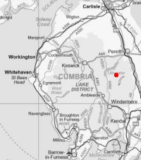
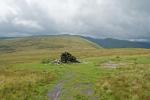
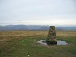
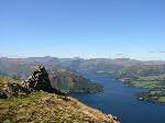
Wether Hill
Height: 670m/2,198ft
Grid Reference: NY456167
Lists: FRCC (106) Wainwright (FE.17)
Ascents: 10
Wainwright's Far Eastern Fells guide book published in 1957 states Wether Hill's height as approximately 2,210ft but the OS 1:25,000 map now records 670m (2,198ft)
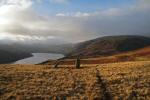
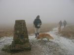
Sat 12 Apr 2014 - Wether Hill and High Raise from Burnbanks
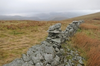
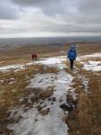
Burnbanks - Four Stones Hill - standing stones - Low Kop - High Kop - Wether Hill - Raven Howe - High Raise - Low Raise - Castle Crag - Haweswater shore path - Burnbanks [13.25 miles 2,850ft ascent]
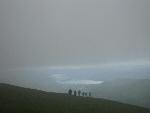
Sun 14 Mar 2010 - Loadpot Hill and Fusedale
Roehead - The Cockpit, Moor Divock - White Knott - Arthur's Pike - Loadpot Hill - Wether Hill - Fusedale - St. Peter's Church, Martindale [9.00 miles 1,950ft ascent]
Fri 1 Aug 2008 - A Cawdale Round
Moorahill Farm - The Pen - Loadpot Hill - Wether Hill - Low Kop - The Hause - Moorahill Farm [6.75 miles 1,350ft ascent]
Sat 12 Jan 2008 - Wether Hill and High Raise from Burnbanks
Burnbanks - Pinnacle Howe - Four Stones Hill - standing stones - Bampton Fell - Low Kop - High Kop - Wether Hill - Red Crag - Redcrag Tarn - Raven Howe - High Raise - Low Raise - Long Grain - Measand End - Measand Beck - Haweswater - Burnbanks [11.75 miles 2,550ft ascent]
Wed 25 Oct 2006 - High Raise from Bampton
Bampton - Cawdale - The Pen - Loadpot Hill - Wether Hill - Red Crag - Redcrag Tarn - Raven Howe - High Raise - Low Raise - Long Grain - Measand End - Measand Beck - standing stones - Four Stones Hill - Drybarrows - Bampton [12.75 miles 2,700ft ascent]
Sat 2 Jul 2005 - High Street Roman Road (BROCAVVM to GALAVA)
Brougham Castle (BROCAVVM ROMAN FORT) - Brougham Hall - Eamont Bridge - Yanwath - Tirril - Winder Hall Farm - Moor Divock - The Cockpit - Loadpot Hill - Wether Hill - Red Crag - Raven Howe - High Raise - Rampsgill Head - Straits of Riggindale - High Street - Thornthwaite Crag - Scot Rake - Hagg Gill - Troutbeck Park - Ing Lane - Troutbeck - Robin Lane - Jenkin Crag - GALAVA ROMAN FORT (Ambleside) [23.50 miles 4,100ft ascent]
Sat 14 May 2005 - The Nab plus ten (A Martindale Round)
St. Peter's Church (Martindale) - Steel Knotts - Wether Hill - Red Crag - Redcrag Tarn - Raven Howe - High Raise - Kidsty Pike - Rampsgill Head - The Knott - Rest Dodd - The Nab - Satura Crag - Brock Crags - Angle Tarn - Angletarn Pikes - Beda Fell - Winter Crag - St. Peter's Church [14.25 miles 4,400ft ascent]
Sat 13 Sep 2003 - The Fusedale Skyline
Howtown - White Knott - Arthur's Pike - Bonscale Pike - Loadpot Hill - Wether Hill - Steel Knotts - Howtown [10.00 miles 2,400ft ascent]
Sun 30 Dec 2001 - Howtown circuit
Howtown - Steel Knotts - Wether Hill - Loadpot Hill - Arthur's Pike - Bonscale Pike - Howtown [8.00 miles 2,400ft ascent]
Sat 14 Aug 1993 - Ramps Gill Round
Martindale Old Church - Loadpot Hill - Wether Hill - Red Crag - High Raise - Kidsty Pike - Rampsgill Head - The Knott - Rest Dodd - The Nab - Martindale Old Church [12.75 miles 3,285ft ascent]