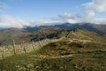
Troutbeck Tongue
Height: 364m/1,191ft
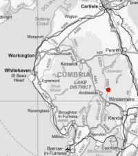
Grid Reference: NY422064
Lists: FRCC (231) Wainwright (FE.36)
Ascents: 4
Per the OS 1:25,000 properly named 'The Tongue', Troutbeck Park
Sat 1 Nov 2008 - A Troutbeck Circuit
Troutbeck Church - Troutbeck - Nanny Lane - Wansfell Pike - Wansfell (Baystones) - Woundale Raise - St Raven's Edge - Stony Cove Pike (Caudale Moor) - Threshthwaite Mouth - Park Fell Head - bottom of Scot Rake - Troutbeck Tongue - Long Green Head - Limefitt Park - Troutbeck Church [12.50 miles 3,400ft ascent]
Sat 28 Oct 2006 - Troutbeck Tongue
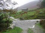
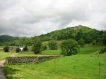
Troutbeck Church - above Limefitt Park - Long Green Head - south ridge - Troutbeck Tongue - slate bridge - Troutbeck Park Farm - Hagg Bridge - Ing Bridge - Ing Lane - A592 - Troutbeck Church [6.50 miles 1,050ft ascent]
Wed 21 Jul 2004 - Troutbeck Tongue
Town Head, Troutbeck - Ing Lane - Hagg Bridge - Troutbeck Park Farm - slate bridge - Troutbeck Tongue - north ridge - Hagg Gill - Hagg Bridge - Ing Lane - Town Head [6.50 miles 900ft ascent]
Sun 2 Dec 2001 - Ill Bell ridge
Troutbeck Church - Garburn Road - Backstone Barrow - Sour Howes - Sallows - Garburn Nook - Garburn Pass - Yoke - Ill Bell - Froswick - Thornthwaite Crag - Scot Rake - Troutbeck Tongue - slate bridge - Troutbeck Park Farm - Hagg Bridge - Ing Bridge - Ing Lane - A592 - Troutbeck Church [12.50 miles 3,500ft ascent]